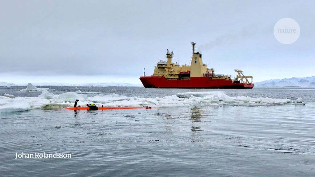
Taking advantage of rare ice-free waters in West Antarctica last February, scientists got their first look underneath Thwaites Glacier, a massive and increasingly unstable formation perched at the edge of the continent. What they saw only increased fears of a collapse that could raise global sea levels by more than half a metre. Data gathered by a robotic submarine deployed by scientists with the International Thwaites Glacier Collaboration suggest that warm water from the deep ocean is welling up from three directions and mixing underneath the ice.
“Thwaites has got these three guns pointed right at it,” says Erin Pettit, a glaciologist at Oregon State University in Corvallis and a co-leader of the five-year, US$50-million project to assess the glacier’s stability. “There is warm water coming from all directions.” She presented initial results from the first two years of the project this week at the American Geophysical Union’s ocean science meeting in San Diego, California.
The warm currents could further destabilize the glacier, which is as large as the island of Great Britain and holds enough ice to boost global sea levels by an estimated 65 centimetres (see 'A precarious position'). If it collapses, Thwaites could take other parts of the western Antarctic ice sheet with it and become the single largest driver of sea-level-rise this century.
Fearing that its collapse has already begun, scientists in the United States and the United Kingdom launched an unprecedented research programme in 2019 involving six field studies and two modelling teams. Pettit’s team is focusing on the glacier’s ice shelf, which extends across more than 100 kilometres of open ocean and acts as a cork holding back ice on land. Other groups are studying the glacier’s flow on land and the ocean circulation; all the data will feed into the modelling.
“We’ve never seen an ice sheet disintegrate in a warming climate, so we’re struggling to project how it could happen,” says Ted Scambos, a glaciologist at the National Snow and Ice Data Center in Boulder, Colorado, and a coordinator of the Thwaites research consortium.
Drama under the ice
Last year’s expedition was the first to actually reach the front of the Thwaites ice shelf, which is usually locked in sea ice. “The conditions were perfect: calm seas, open water,” says Anna Wåhlin, an oceanographer with the University of Gothenburg in Sweden who led the underwater work. “We could nearly touch the ice.”
The team sent their robot Rán — named after the Norse goddess of the sea — out under the shelf to gather data that have been used to compile the most detailed seafloor maps ever produced of the region, as well as information about ocean conditions and currents.
The shelf is divided into two sections: the more stable eastern side is underpinned by a rocky outcrop and flows around 600 metres per year, while the western side is moving more rapidly at 2 kilometres per year. The new data suggest that a deep, warm current is rolling along the coast from the adjacent Pine Island glacier and mixing with other warm currents underneath the eastern shelf. If the eastern side falls apart, Pettit says, then the entire equation will change.
How ocean currents interact with ice shelves is one of the most important questions in oceanography, and every data point matters, says Matthew England, an oceanographer at the University of New South Wales in Sydney, Australia. “This gives us an idea of what the models need to be doing.”
Melting hopes
During the Antarctic field season that ended this month, Pettit's team worked directly on the ice shelf. Researchers conducted seismic tests to study the seafloor and drilled through 300 metres of ice to deploy sensors that will monitor ocean conditions for the next two years.
But Pettit says the main surprise this year came from radar data detailing the structure of the ice shelf. Thwaites’s underbelly is a landscape unto itself, complete with channels, ridges and cliffs, all crafted by warm currents, she says. “It’s not just a flat sheet of ice that is melting uniformly. It’s more complex than we thought.”
If all goes according to plan next year, Rán will conduct a larger mapping mission all the way to where the main body of the glacier rests on bedrock. Gliders and other instruments will gather as much data as possible about ocean currents and seafloor topography under the shelf, Wåhlin says.
Wåhlin is confident that by the end of the project, three years from now, her team will have some answers about Thwaites’s future. “Then we should know much more about the risks,” she says. “It would be shameful if we don’t.”


